Bunker Hill Announces $50 Million Project Finance Package, Mine Purchase, And US EPA Settlement Agreement Amendment
Research, News, and Market Data on Bunker Hill Mining
Bunker Hill to Host Live Interactive 6ix Summit on Wednesday, December 22 @ 11:00am ET / 8:00am PT
HIGHLIGHTS
- $50 million term sheet executed with Sprott Private Resource Streaming and Royalty Corp (“SRSR”) outlining a proposed financing package to fund mine restart in stages:
- $8 million Royalty Convertible Debenture: 9.0% debt convertible to 1.85% life of mine royalty to fund mine purchase, initial EPA payment and on-going engineering. Closing expected in January 2022
- $5 million Convertible Debenture: 7.5% interest, repaid or convertible at CAD 0.30 per share, to fund further engineering to PFS level by beginning of Q2 2022. Closing expected in January 2022
- Stream: up to $37 million for up to 10% of all metals produced until certain quantities delivered; up to 2% thereafter, to fund majority of restart capital from Q2 2022. Closing expected by early Q2 2022
- The Company retains option to re-purchase 50% of Stream at 1.40x multiple of stream funding until 2025
- Mine purchase: agreement executed for $5.4 million all-cash purchase from Placer Mining
- EPA Settlement Agreement amendment: agreement executed with US EPA and IDEQ for deferral of $17 million of existing $19 million liability to be paid from free cash flow during 2024-2029
NEXT STEPS
- Construction decision expected post detailed engineering and mine plan optimization by early Q2 2022
- Prefeasibility Study concurrent with construction decision, incorporating the 59% increase in M&I resources
- Further non-dilutive financing options being explored to minimize any equity financing requirement in 2022
- TSX-V Listing Committee discussions ongoing; material balance sheet improvement supports application
- Chairman Richard Williams interviewed live by Kai Hoffmann today at 5:30pm ET / 2:30pm PT on SF Live. Live broadcast and replay available at YouTube.com/soarfinancial or twitter.com/soarfinancial
- Chairman Richard Williams, CEO Sam Ash and CFO David Wiens to host live interactive 6ix virtual investor event on Wednesday, December 22 at 11:00am ET / 8:00am PT. Investors are invited to register at: [ LINK ]
TORONTO, Dec. 20, 2021 (GLOBE NEWSWIRE) — Bunker Hill Mining Corp. (the “Company”) (CSE: BNKR; OTCQB: BHLL) is pleased to announce the achievement of its key short-term objectives, including the execution of a non-binding term sheet outlining a $50 million non-dilutive project finance package, the purchase of the Bunker Hill Mine, and the execution of a settlement agreement amendment with the US Environmental Protection Agency (“US EPA” or “EPA”). All figures in this news release are in US dollars unless otherwise stated.
Sam Ash, CEO, stated “We are exceedingly pleased to announce the accomplishment of our key objectives, most notably a proposed $50 million project finance package that we expect to provide the majority of our funding requirements in a non-dilutive manner. Together with the purchase of the mine and an amended settlement agreement with the EPA, a rapid restart of the prolific Bunker Hill Mine is now clearly within sight. This will provide enormous social and economic benefits to northern Idaho, significant returns for our shareholders, and allow us to honor our commitments to the EPA. We look forward to next steps, including advancement to a formal construction decision and the review of our revised TSX-V Exchange listing application”.
$50 MILLION PROJECT FINANCE PACKAGE
The Company has executed a non-binding term sheet with SRSR outlining a $50 million project finance package that the Company expects to fulfill the majority of its funding requirements to restart the mine and reach commercial production in mid-2023. The package consists of an $8 million Royalty Convertible Debenture, a $5 million Convertible Debenture, and a multi-metals Stream of up to $37 million.
Subject to settlement of definitive documentation with SRSR, the Company expects that $8 million will be advanced under the Royalty Convertible Debenture in January 2022. These proceeds will fund the purchase of the Bunker Hill Mine and near-term working capital requirements, including a $2 million payment to the EPA in January 2022 (see “EPA Settlement Agreement Amendment” section below). The Royalty Convertible Debenture will initially bear interest at an annual rate of 9.0%, payable in cash or shares at the Company’s option, until such time that SRSR elects to convert it into a Royalty, with such conversion option expiring at the earlier of advancement of the Stream or 18 months. In the event of conversion, the Royalty Convertible Debenture will cease to exist and the Company will grant a Royalty for 1.85% of life-of-mine gross revenue from mining claims considered to be historically worked, contiguous to current accessible underground development, and covered by the Company’s 2021 ground geophysical survey. A 1.35% rate will apply to claims outside of these areas. The Royalty Convertible Debenture will initially be secured by a share pledge of the Company’s operating subsidiary, until such time that a full security package is put in place. In the event of non-conversion, the principal of the Royalty Convertible Debenture will be repayable in cash.
Subject to settlement of definitive documentation with SRSR, the Company expects that an aggregate amount of $5 million will be advanced under the Convertible Debenture, also in January 2022. These proceeds will fund capital expenditures and working capital requirements in Q1 2022. The Convertible Debenture will bear interest at an annual rate of 7.5%, payable in cash or shares at the Company’s option, and a maturity of 18 months from the closing of the Royalty Convertible Debenture. Until the closing of the Stream, the Convertible Debenture is convertible into shares of the Company at a share price of CAD 0.30 per share. Alternatively, SRSR may elect to retire the Convertible Debenture with the cash proceeds of the Stream. The Company may elect to re-pay the Convertible Debenture early; if SRSR elects not to exercise its conversion option at such time, a minimum of 12 months of interest would apply.
SRSR has concluded its initial due diligence process, including a site visit to the Bunker Hill Mine and a detailed project review by third party engineering and geological consultants, and has obtained Investment Committee approval to fund the $8 million Royalty Convertible Debenture and $5 million Convertible Debenture.
Subject to SRSR internal approvals, further technical and other diligence (including confirmation of full project funding by an independent engineer appointed by SRSR), and satisfactory definitive documentation, the Company expects to close the Stream concurrent with a formal construction decision being made by early Q2 2022. A minimum of $27 million and a maximum of $37 million (the “Stream Amount”) will be made available under the Stream, at the Company’s option, once the conditions for availability of the Stream have been satisfied. Assuming the maximum funding of $37 million is drawn, the Stream would apply to 10% of payable metals sold until a minimum quantity of metal is delivered consisting of, individually, 55 million pounds of zinc, 35 million pounds of lead, and 1 million ounces of silver. Thereafter, the Stream would apply to 2% of payable metals sold. If the Company elects to draw less than $37 million under the Stream, the percentage and quantities of payable metals streamed will adjust pro-rata. The delivery price of streamed metals will be 20% of the applicable spot price.
The Company may buy back 50% of the Stream Amount at a 1.40x multiple of the Stream Amount between the second and third anniversary of the date of funding, and at a 1.65x multiple of the Stream Amount between the third and fourth anniversary of the date of funding. The Company will be permitted to incur additional indebtedness of $15 million and a cost over-run facility of $13 million from other financing counterparties.
Closing of the Royalty Convertible Debenture, Convertible Debenture, and Stream are conditional on the conclusion of a number of matters, including finalization of definitive documentation, regulatory and stock exchange approvals, and closing of the purchase of the Bunker Hill Mine.
PURCHASE OF THE BUNKER HILL MINE
With the execution of the EPA settlement agreement amendment and the expected receipt of $8 million proceeds from the Royalty Convertible Debenture, the Company has exercised its option to purchase the Bunker Hill Mine from Placer Mining Corp. and a definitive agreement has been signed by both parties. The terms of the purchase were modified to $5.4 million in cash, from $3.4 million of cash and $2.0 million of common shares in the Company.
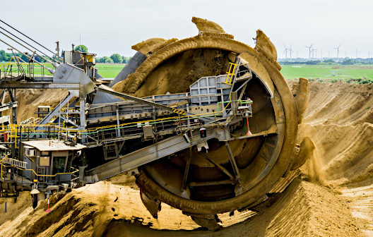
Purchase of the mine consists of over 400 patented mining claims and 5,800 acres of private land, an ideal scenario with respect to permitting considerations. The extensive in-place infrastructure and significant mineral potential included in the acquisition positions Bunker Hill for a rapid restart, and a return to free cash flow generation with exceptional growth potential in can be considered the pre-eminent silver mining district in the world.
Closing of the transaction is expected in January 2022, concurrent with funding of the Royalty Convertible Debenture, approval of the transaction by Placer Mining Corp. shareholders, and satisfaction of other closing conditions.
EPA SETTLEMENT AGREEMENT AMENDMENT
The amended Settlement Agreement (the “Amendment”) between the Company, Idaho Department of Environmental Quality, US Department of Justice and US EPA modifies the payment schedule and payment terms for recovery of historical environmental response costs at Bunker Hill Mine by US EPA. A total of $19 million remains to be paid by the Company. The new payment schedule includes a $2 million payment to US EPA within 30 days of execution of this amendment. The remaining $17 million will be paid on the following dates:
| Date |
Amount |
| November 1, 2024 |
$3,000,000 |
| November 1, 2025 |
$3,000,000 |
| November 1, 2026 |
$3,000,000 |
| November 1, 2027 |
$3,000,000 |
| November 1, 2028 |
$3,000,000 |
| November 1, 2029 |
$2,000,000 plus accrued interest |
The resumption of payments in 2024 were agreed in order to allow the Company to generate enough revenue from mining activities at the Bunker Hill Mine to address remaining payment obligations from free cash flow.
The Amendment includes an additional payment for outstanding water treatment costs that have been incurred over the period from 2018 through 2020. This $2.9 million payment will be made within 90 days of the execution of the Amendment. With the execution of the Amendment, the Company is now fully compliant with the terms of the Settlement Agreement.
In addition to the changes in payment terms and schedule, the Company has committed to securing Financial Assurance in the form of performance bonds or letters of credit deemed acceptable to the EPA. The Financial Assurance will total $17 million, corresponding to the Company’s obligations to be paid in the 2024-2029 period as outlined above, that can be drawn on by US EPA in the event of non-performance by the Company. The amount of the bonds will decrease over time as individual payments are made. If the Company does not post the Financial Assurance within 90 days of execution of the Amendment, it must issue an irrevocable letter of credit for $9 million. US EPA may draw on this letter of credit after an additional 90 days if the Company is unable to either put the Financial Assurance in place or make payment for the full $17 million of remaining historical cost recovery sums. In the event neither occurs, the terms of the initial Settlement Agreement will be reinstated.
The Company has concluded the negotiation of commercial terms with two counterparties for the full $17 million Financial Assurance, with finalization contingent on full project funding being in place, including the Stream.
The Settlement Agreement was reached in 2018 in order for the US EPA to gain confidence that it will be repaid for historical environmental response costs it incurred for Bunker Hill Mine. The costs up to that point had been unpaid by the owner of the mine since 1994. The Company agreed to become a Responsible Party for these liabilities in exchange for the US EPA and US Department of Justice eliminating all other potential historical environmental liabilities related to the mine, specifically all CERCLA- or Superfund-related liabilities. The inability of the Company to meet payment obligations, however, meant that until the signing of the Amendment, it was in arrears for $11 million in cost recovery payments and over $2.9 million in unpaid water treatment costs. As of today, the Company is now fully compliant with the terms of the Settlement Agreement with US EPA.
NEXT STEPS
With the approval by SRSR’s Investment Committee of the $8 million Royalty Convertible Debenture and $5 million Convertible Debenture (subject to finalization of definitive documentation and other conditions precedent), and the execution of the mine purchase option and Settlement Agreement amendment, the Company is focused on accelerating the sustainable restart of the mine to commercial production in mid-2023. This includes progressing detailed engineering and mine planning to PFS level, purchasing a process plant, confirming and securing remaining capital requirements (including funding of the Stream), and upgrading the Company’s listing to the TSX Venture Exchange.
Detailed engineering for full project restart is well underway with geotechnical, metallurgical optimization, plant design, electrical infrastructure, water treatment, and geotechnical paste studies progressing well. This technical work is expected to result in significant value creation and support a construction decision by early Q2 2022, concurrent with a Prefeasibility Study incorporating the recently announced 59% increase in Measured and Indicated. Project completion and commercial production is anticipated to occur in the second half of 2023.
Together with its financial advisor, Cutfield Freeman & Co., the Company is evaluating alternatives to secure further non-dilutive funding of up to $15 million as a project finance facility and up to $13 million as a cost over-run facility, as permitted in the Company’s $50 million project financing package. This would minimize any equity financing requirements to fully fund the mine restart.
With the material balance sheet improvements effected by the transactions described in this news release, the Company has re-engaged with the TSX-V Listing Committee regarding its application for an upgrade of its listing from the CSE to the TSX Venture Exchange. This application is currently under review.
ABOUT BUNKER HILL MINING CORP.
Under new Idaho-based leadership the Bunker Hill Mining Corp, intends to sustainably restart and develop the Bunker Hill Mine as the first step in consolidating a portfolio of North American precious-metal assets with a focus on silver. Information about the Company is available on its website, www.bunkerhillmining.com, or within the SEDAR and EDGAR databases.
For additional information contact:
David Wiens, CFA
CFO & Corporate Secretary
+1 208 370 3665
ir@bunkerhillmining.com
CAUTIONARY STATEMENTS
Certain statements in this news release are forward-looking and involve a number of risks and uncertainties. Such forward-looking statements are within the meaning of that term in Section 27A of the Securities Act of 1933, as amended, and Section 21E of the Securities Exchange Act of 1934, as amended, as well as within the meaning of the phrase ‘forward-looking information’ in the Canadian Securities Administrators’ National Instrument 51-102 – Continuous Disclosure Obligations. Forward-looking statements are not comprised of historical facts. Forward-looking statements include estimates and statements that describe the Company’s future plans, objectives or goals, including words to the effect that the Company or management expects a stated condition or result to occur. Forward-looking statements may be identified by such terms as “believes”, “anticipates”, “expects”, “estimates”, “may”, “could”, “would”, “will”, or “plan”. Since forward-looking statements are based on assumptions and address future events and conditions, by their very nature they involve inherent risks and uncertainties. Although these statements are based on information currently available to the Company, the Company provides no assurance that actual results will meet management’s expectations. Risks, uncertainties and other factors involved with forward-looking information could cause actual events, results, performance, prospects and opportunities to differ materially from those expressed or implied by such forward-looking information. Forward looking information in this news release includes, but is not limited to, the Company’s intentions regarding: its objectives, goals or future plans and statements; completing the acquisition of the Bunker Hill Mine; closing the financing package as described herein with SRSR; the financing package with SRSR being sufficient for the purposes described herein; the Company’s ability to secure additional financing, whether dilutive or non-dilutive; the Company’s ability to progress detailed engineering of the Bunker Hill Mine; the Company’s ability to purchasing a processing plant; the Company’s ability to restart production at the Bunker Hill Mine; the Company’s ability to generate free cash flow from the Bunker Hill Mine; the Company’s ability to complete payments to the U.S. EPA from free cash flow generated from the Bunker Hill Mine; and the listing of the Company’s shares on the TSX-V . Factors that could cause actual results to differ materially from such forward-looking information include, but are not limited to: the ability to predict and counteract the effects of COVID-19 on the business of the Company, including but not limited to the effects of COVID-19 on the price of commodities, capital market conditions, restriction on labour and international travel and supply chains; the TSX-V not approving the listing of the Company’s shares on the TSX-V; failure to identify mineral resources; failure to convert estimated mineral resources to reserves; the inability to complete a feasibility study which recommends a production decision; the preliminary nature of metallurgical test results; the Company’s ability to restart and develop the Bunker Hill Mine and the risks of not basing a production decision on a feasibility study of mineral reserves demonstrating economic and technical viability, resulting in increased uncertainty due to multiple technical and economic risks of failure which are associated with this production decision including, among others, areas that are analyzed in more detail in a feasibility study, such as applying economic analysis to resources and reserves, more detailed metallurgy and a number of specialized studies in areas such as mining and recovery methods, market analysis, and environmental and community impacts and, as a result, there may be an increased uncertainty of achieving any particular level of recovery of minerals or the cost of such recovery, including increased risks associated with developing a commercially mineable deposit with no guarantee that production will begin as anticipated or at all or that anticipated production costs will be achieved; failure to commence production would have a material adverse impact on the Company’s ability to generate revenue and cash flow to fund operations; failure to achieve the anticipated production costs would have a material adverse impact on the Company’s cash flow and future profitability; delays in obtaining or failures to obtain required governmental, environmental or other project approvals; political risks; changes in equity markets; uncertainties relating to the availability and costs of financing needed in the future; the inability of the Company to budget and manage its liquidity in light of the failure to obtain additional financing, including the ability of the Company to complete the payments to the Placer Mining Corporation and the U.S. EPA pursuant to the terms of the agreement to acquire the Bunker Hill Mine; inflation; changes in exchange rates; fluctuations in commodity prices; delays in the development of projects; capital, operating and reclamation costs varying significantly from estimates and the other risks involved in the mineral exploration and development industry; the cost, timing and ability to implement ESG initiatives which may not be technically successful or economically viable; and those risks set out in the Company’s public documents filed on SEDAR. Although the Company believes that the assumptions and factors used in preparing the forward-looking information in this news release are reasonable, undue reliance should not be placed on such information, which only applies as of the date of this news release, and no assurance can be given that such events will occur in the disclosed time frames or at all. The Company disclaims any intention or obligation to update or revise any forward-looking information, whether as a result of new information, future events or otherwise, other than as required by law. No stock exchange, securities commission or other regulatory authority has approved or disapproved the information contained herein.