Release – Aurania Resources Reports Elevated Silver-Zinc Has Been Discovered In Outcrop Over 2.7 Kilometres At Tiria-Shimpia


Aurania Reports Elevated Silver-Zinc Has Been Discovered In Outcrop Over 2.7 Kilometres At Tiria-Shimpia


Toronto, Ontario, May 21, 2021 – Aurania Resources Ltd. (TSXV: ARU) (OTCQB: AUIAF) (Frankfurt: 20Q) (“Aurania” or the “Company”) reports that follow-up of a high-grade boulder found in a stream has led to the discovery of silver-zinc mineralization in outcrop over 2.7 kilometres (“km”) in the Tiria-Shimpia target area in the Company’s Lost Cities – Cutucu Project (“Project”) in southeastern Ecuador.

Follow-up exploration, together with the on-going channel sampling of the mineralized layers where they are exposed at surface, is providing key information on the distribution of grade on surface within the 15km trend along which silver-zinc is located at Tiria-Shimpia. This trend was recently extended to a total of 22km after the discovery of a 7km long mineralized zone at Shimpia North (see press release dated April 30, 2021).  Within the 2.7km mineralized zone, there is a 500 metre (“m”) segment of high-grade material with silver up to 73 grams per tonne (“g/t”) and zinc up to 49% (Figure 1).  The high-grade mineralization is open to the north where there is a gap in outcrop of about 1km.

The mineralized sedimentary layer corresponds closely with silver enrichment in soil (Figure 1) and remains open to the south.  In fact, there is a second band of elevated silver in soil that suggests that there is a second mineralized layer in the sedimentary strata, but no outcrop has yet been found of the suspected second layer. A third level of mineralization has been found to the west with the discovery of low-grade outcrop that returned up to 2% zinc.  Zinc and silver enrichment continues to the southern limit of ridge and spur soil sampling, and there is therefore potential for the silver-zinc zone to extend further south.

Figure 1.  Plan view of the distribution of elevated silver in soil (orange shapes) and geological faults (black ticked lines) in the Tiria-Shimpia area showing the location of rock samples from outcrop over a 2.7km trend within the 15km-long Tiria-Shimpia target.

Geological Details of the Area Sampled

Silver-zinc mineralization is concentrated in the sedimentary layering in crackle-brecciated dolomitic limestone.  Sphalerite and barite occur in veinlets and as fill between rock fragments in the breccia.  The mineralization occurs in sedimentary layering that is folded across north-northwest – trending hinge lines.

Sample Analysis & Quality Assurance / Quality Control (“QAQC”) 

Laboratories: The soil samples were prepared for analysis at MS Analytical (“MSA”) in Cuenca, Ecuador, and the analyses were done in Vancouver, Canada.

Sample preparation: The rock samples were jaw-crushed to 10 mesh (crushed material passes through a mesh with apertures of 2 millimetres (“mm”)), from which a one-kilogram sub-sample was taken.  The sub-sample was crushed to a grain size of 0.075mm and a 200 gram (“g”) split was set aside for analysis.

Analytical procedure:  Approximately 0.25g of rock pulp underwent four-acid digestion and analysis for 48 elements by ICP-MS.  For the over-limit samples, those that had a grade of greater than 1% zinc and lead, and 100g/t silver, 0.4g of pulp underwent digestion in four acids and the resulting liquid was diluted and analyzed by ICP-MS.

QAQC: Aurania personnel inserted a certified standard pulp sample, alternating with a field blank, at approximate 20 sample intervals in all sample batches. Aurania’s analysis of results from its independent QAQC samples showed the batches reported on above, lie within acceptable limits.  In addition, the labs reported that the analyses had passed their internal QAQC tests.

Qualified Person

The geological information contained in this news release has been verified and approved by Jean-Paul Pallier, MSc.  Mr. Pallier is a designated EurGeol by the European Federation of Geologists and a Qualified Person as defined by National Instrument 43-101, Standards of Disclosure for Mineral Projects of the Canadian Securities Administrators.

About Aurania

Aurania is a mineral exploration company engaged in the identification, evaluation, acquisition and exploration of mineral property interests, with a focus on precious metals and copper in South America.  Its flagship asset, The Lost Cities – Cutucu Project, is located in the Jurassic Metallogenic Belt in the eastern foothills of the Andes mountain range of southeastern Ecuador.

Information on Aurania and technical reports are available at www.aurania.com and www.sedar.com, as well as on Facebook at https://www.facebook.com/auranialtd/, Twitter at  https://twitter.com/auranialtd, and LinkedIn at https://www.linkedin.com/company/aurania-resources-ltd-.

For further information, please contact:

Carolyn Muir

VP Investor Relations

Aurania Resources Ltd.

(416) 367-3200

carolyn.muir@aurania.com

Dr. Richard Spencer

President

Aurania Resources Ltd.

(416) 367-3200

richard.spencer@aurania.com

Neither the TSX Venture Exchange nor its Regulation Services Provider (as that term is defined in the policies of the TSX Venture Exchange) accepts responsibility for the adequacy or accuracy of this release.

Forward-Looking Statements

This news release may contain forward-looking information that involves substantial known and unknown risks and uncertainties, most of which are beyond the control of Aurania. Forward-looking statements include estimates and statements that describe Aurania’s future plans, objectives or goals, including words to the effect that Aurania or its management expects a stated condition or result to occur. Forward-looking statements may be identified by such terms as “believes”, “anticipates”, “expects”, “estimates”, “may”, “could”, “would”, “will”, or “plan”. Since forward-looking statements are based on assumptions and address future events and conditions, by their very nature they involve inherent risks and uncertainties. Although these statements are based on information currently available to Aurania, Aurania provides no assurance that actual results will meet management’s expectations. Risks, uncertainties and other factors involved with forward-looking information could cause actual events, results, performance, prospects and opportunities to differ materially from those expressed or implied by such forward-looking information. Forward looking information in this news release includes, but is not limited to Aurania’s objectives, goals or future plans, statements, exploration results, potential mineralization, the corporation’s portfolio, treasury, management team and enhanced capital markets profile, the estimation of mineral resources, exploration, timing of the commencement of operations and estimates of market conditions. Factors that could cause actual results to differ materially from such forward-looking information include, but are not limited to, failure to identify mineral resources, failure to convert estimated mineral resources to reserves, the inability to complete a feasibility study which recommends a production decision, the preliminary nature of metallurgical test results, delays in obtaining or failures to obtain required governmental, regulatory, environmental or other project approvals, political risks, inability to fulfill the duty to accommodate indigenous peoples, uncertainties relating to the availability and costs of financing needed in the future, changes in equity markets, inflation, changes in exchange rates, fluctuations in commodity prices, delays in the development of projects, capital and operating costs varying significantly from estimates and the other risks involved in the mineral exploration and development industry, the effects of COVID-19 on the business of the Company including but not limited to the effects of COVID-19 on the price of commodities, capital market conditions, restrictions on labour and international travel and supply chains, and those risks set out in Aurania’s public documents filed on SEDAR. Although Aurania believes that the assumptions and factors used in preparing the forward-looking information in this news release are reasonable, undue reliance should not be placed on such information, which only applies as of the date of this news release, and no assurance can be given that such events will occur in the disclosed time frames or at all. Aurania disclaims any intention or obligation to update or revise any forward-looking information, whether as a result of new information, future events or otherwise, other than as required by law.

Aurania Resources Reports Elevated Silver-Zinc Has Been Discovered In Outcrop Over 2.7 Kilometres At Tiria-Shimpia


Aurania Reports Elevated Silver-Zinc Has Been Discovered In Outcrop Over 2.7 Kilometres At Tiria-Shimpia


Toronto, Ontario, May 21, 2021 – Aurania Resources Ltd. (TSXV: ARU) (OTCQB: AUIAF) (Frankfurt: 20Q) (“Aurania” or the “Company”) reports that follow-up of a high-grade boulder found in a stream has led to the discovery of silver-zinc mineralization in outcrop over 2.7 kilometres (“km”) in the Tiria-Shimpia target area in the Company’s Lost Cities – Cutucu Project (“Project”) in southeastern Ecuador.

Follow-up exploration, together with the on-going channel sampling of the mineralized layers where they are exposed at surface, is providing key information on the distribution of grade on surface within the 15km trend along which silver-zinc is located at Tiria-Shimpia. This trend was recently extended to a total of 22km after the discovery of a 7km long mineralized zone at Shimpia North (see press release dated April 30, 2021).  Within the 2.7km mineralized zone, there is a 500 metre (“m”) segment of high-grade material with silver up to 73 grams per tonne (“g/t”) and zinc up to 49% (Figure 1).  The high-grade mineralization is open to the north where there is a gap in outcrop of about 1km.

The mineralized sedimentary layer corresponds closely with silver enrichment in soil (Figure 1) and remains open to the south.  In fact, there is a second band of elevated silver in soil that suggests that there is a second mineralized layer in the sedimentary strata, but no outcrop has yet been found of the suspected second layer. A third level of mineralization has been found to the west with the discovery of low-grade outcrop that returned up to 2% zinc.  Zinc and silver enrichment continues to the southern limit of ridge and spur soil sampling, and there is therefore potential for the silver-zinc zone to extend further south.

Figure 1.  Plan view of the distribution of elevated silver in soil (orange shapes) and geological faults (black ticked lines) in the Tiria-Shimpia area showing the location of rock samples from outcrop over a 2.7km trend within the 15km-long Tiria-Shimpia target.

Geological Details of the Area Sampled

Silver-zinc mineralization is concentrated in the sedimentary layering in crackle-brecciated dolomitic limestone.  Sphalerite and barite occur in veinlets and as fill between rock fragments in the breccia.  The mineralization occurs in sedimentary layering that is folded across north-northwest – trending hinge lines.

Sample Analysis & Quality Assurance / Quality Control (“QAQC”) 

Laboratories: The soil samples were prepared for analysis at MS Analytical (“MSA”) in Cuenca, Ecuador, and the analyses were done in Vancouver, Canada.

Sample preparation: The rock samples were jaw-crushed to 10 mesh (crushed material passes through a mesh with apertures of 2 millimetres (“mm”)), from which a one-kilogram sub-sample was taken.  The sub-sample was crushed to a grain size of 0.075mm and a 200 gram (“g”) split was set aside for analysis.

Analytical procedure:  Approximately 0.25g of rock pulp underwent four-acid digestion and analysis for 48 elements by ICP-MS.  For the over-limit samples, those that had a grade of greater than 1% zinc and lead, and 100g/t silver, 0.4g of pulp underwent digestion in four acids and the resulting liquid was diluted and analyzed by ICP-MS.

QAQC: Aurania personnel inserted a certified standard pulp sample, alternating with a field blank, at approximate 20 sample intervals in all sample batches. Aurania’s analysis of results from its independent QAQC samples showed the batches reported on above, lie within acceptable limits.  In addition, the labs reported that the analyses had passed their internal QAQC tests.

Qualified Person

The geological information contained in this news release has been verified and approved by Jean-Paul Pallier, MSc.  Mr. Pallier is a designated EurGeol by the European Federation of Geologists and a Qualified Person as defined by National Instrument 43-101, Standards of Disclosure for Mineral Projects of the Canadian Securities Administrators.

About Aurania

Aurania is a mineral exploration company engaged in the identification, evaluation, acquisition and exploration of mineral property interests, with a focus on precious metals and copper in South America.  Its flagship asset, The Lost Cities – Cutucu Project, is located in the Jurassic Metallogenic Belt in the eastern foothills of the Andes mountain range of southeastern Ecuador.

Information on Aurania and technical reports are available at www.aurania.com and www.sedar.com, as well as on Facebook at https://www.facebook.com/auranialtd/, Twitter at  https://twitter.com/auranialtd, and LinkedIn at https://www.linkedin.com/company/aurania-resources-ltd-.

For further information, please contact:

Carolyn Muir

VP Investor Relations

Aurania Resources Ltd.

(416) 367-3200

carolyn.muir@aurania.com

Dr. Richard Spencer

President

Aurania Resources Ltd.

(416) 367-3200

richard.spencer@aurania.com

Neither the TSX Venture Exchange nor its Regulation Services Provider (as that term is defined in the policies of the TSX Venture Exchange) accepts responsibility for the adequacy or accuracy of this release.

Forward-Looking Statements

This news release may contain forward-looking information that involves substantial known and unknown risks and uncertainties, most of which are beyond the control of Aurania. Forward-looking statements include estimates and statements that describe Aurania’s future plans, objectives or goals, including words to the effect that Aurania or its management expects a stated condition or result to occur. Forward-looking statements may be identified by such terms as “believes”, “anticipates”, “expects”, “estimates”, “may”, “could”, “would”, “will”, or “plan”. Since forward-looking statements are based on assumptions and address future events and conditions, by their very nature they involve inherent risks and uncertainties. Although these statements are based on information currently available to Aurania, Aurania provides no assurance that actual results will meet management’s expectations. Risks, uncertainties and other factors involved with forward-looking information could cause actual events, results, performance, prospects and opportunities to differ materially from those expressed or implied by such forward-looking information. Forward looking information in this news release includes, but is not limited to Aurania’s objectives, goals or future plans, statements, exploration results, potential mineralization, the corporation’s portfolio, treasury, management team and enhanced capital markets profile, the estimation of mineral resources, exploration, timing of the commencement of operations and estimates of market conditions. Factors that could cause actual results to differ materially from such forward-looking information include, but are not limited to, failure to identify mineral resources, failure to convert estimated mineral resources to reserves, the inability to complete a feasibility study which recommends a production decision, the preliminary nature of metallurgical test results, delays in obtaining or failures to obtain required governmental, regulatory, environmental or other project approvals, political risks, inability to fulfill the duty to accommodate indigenous peoples, uncertainties relating to the availability and costs of financing needed in the future, changes in equity markets, inflation, changes in exchange rates, fluctuations in commodity prices, delays in the development of projects, capital and operating costs varying significantly from estimates and the other risks involved in the mineral exploration and development industry, the effects of COVID-19 on the business of the Company including but not limited to the effects of COVID-19 on the price of commodities, capital market conditions, restrictions on labour and international travel and supply chains, and those risks set out in Aurania’s public documents filed on SEDAR. Although Aurania believes that the assumptions and factors used in preparing the forward-looking information in this news release are reasonable, undue reliance should not be placed on such information, which only applies as of the date of this news release, and no assurance can be given that such events will occur in the disclosed time frames or at all. Aurania disclaims any intention or obligation to update or revise any forward-looking information, whether as a result of new information, future events or otherwise, other than as required by law.

Great Bear Resources Ltd. (GTBAF)(GBR:CA) – High-Grade Zones Coming Into Clearer View

Thursday, May 20, 2021

Great Bear Resources Ltd. (GTBAF)(GBR:CA)
High-Grade Zones Coming Into Clearer View

Noble Capital Markets research on Great Bear Resources is published under ticker symbols GTBAF and GBR:CA. The price target is in USD and based on ticker symbol GTBAF. Great Bear Resources Ltd is a gold exploration company. It explores for mineral properties in the Red Lake District in Ontario, Canada. Its property portfolio includes Great Bear’s Red Lake Properties with the flagship Dixie project, Pakwash property, and Sobel property.

Mark Reichman, Senior Research Analyst of Natural Resources, Noble Capital Markets, Inc.

Refer to the full report for the price target, fundamental analysis, and rating.

    Getting more granular. Great Bear released additional drill results which featured high-grade gold intercepts with significant drill indicated core lengths, and reinforced the continuity of high-grade and bulk-tonnage gold mineralization within the LP Fault. Including results for the most recent 17 drill holes, Great Bear has released 300 LP Fault drill holes to date and expects to complete 400 by year-end. The company is modeling 17 distinct high-grade gold domains within the broader LP Fault gold mineralized system. Together, they encompass a strike length of 4.2 kilometers and occur within eight larger lower grade domains. Importantly, Great Bear provided a detailed long section of the upper portion of one of the high-grade domains, a summary of all drill results within the long section, and detailed maps of the high-grade domains within the broader LP Fault gold system.

    Positive implications.  The release of more detailed information about the distinct high-grade gold domains should make it easier for investors to gauge the project’s mineral resource potential. Additionally, it has implications for mine planning as we think the company may have the ability to size a smaller mill and focus on higher grade material initially which could result in robust project …


This Company Sponsored Research is provided by Noble Capital Markets, Inc., a FINRA and S.E.C. registered broker-dealer (B/D).

*Analyst certification and important disclosures included in the full report. NOTE: investment decisions should not be based upon the content of this research summary.  Proper due diligence is required before making any investment decision. 

Release – Great Bear Provides First Detailed High-Grade Long Section


Great Bear Provides First Detailed High-Grade Long Section, Drills 22.79 g/t Gold Over 4.80 metres from Bedrock Surface, and Reaches 300 Reported LP Fault Drill Holes


May 19, 2021 – Vancouver, British Columbia, Canada – Great Bear Resources Ltd. (the “Company” or “Great Bear”, TSX-V: GBR; OTCQX: GTBAF) today reported results from its ongoing fully funded $45 million 2021 exploration program at its 100% owned flagship Dixie Project in the Red Lake district of Ontario.

Chris Taylor, President and CEO of Great Bear said, “We are now entering the final months of near-surface maiden mineral resource estimation drilling of the central LP Fault zone, and are modeling 17 distinct high-grade gold domains within the broader LP Fault gold mineralized system. For the first time, we provide a detailed long section of the upper portion of one of these high-grade domains, a summary of all drill results within that long section, and detailed maps of the high-grade domains within the broader LP Fault gold system.”

Great Bear plans to release detailed high-grade and bulk tonnage domain information over the coming months. This news release includes the first of this information.

Figure 1: Upper 500 m x 250 m area of high-grade domain BR7, showing all results to date. New results are highlighted in orange.

Table 1: All 28 drill holes that intersect the near-surface portion of high-grade domain BR7, along 500 metres of strike length. New results in italics (holes BR-296-299). Note that assay intervals from previously reported drill holes have been clipped to domain BR7.

Drill Hole

From (m)

To (m)

Width* (m)

Gold (g/t)

BR-037

135.30

150.70

15.35

2.23

BR-038

81.20

87.80

6.60

2.96

BR-118

156.00

169.00

13.00

18.57

BR-119

46.60

57.00

10.40

1.45

BR-140

247.00

257.70

10.70

4.12

BR-142

231.00

239.30

8.25

2.53

BR-143

182.00

193.50

11.50

5.26

BR-144

130.00

144.30

14.25

15.31

BR-145

95.60

106.90

11.30

11.47

BR-146

35.75

45.55

9.80

86.97

BR-147

48.00

55.90

7.90

3.79

BR-172

84.00

91.50

7.50

1.12

BR-173

210.00

214.30

4.30

4.12

BR-174

207.00

216.00

9.00

13.82

BR-175

256.00

264.70

8.70

3.84

BR-211

99.80

105.60

5.80

7.80

BR-212

157.00

174.50

17.50

6.62

BR-213

240.30

245.00

4.70

3.66

BR-224

311.50

328.40

16.90

1.16

BR-225

231.75

243.20

11.45

1.50

BR-231

151.00

157.00

6.00

3.43

BR-232

106.20

111.00

4.80

53.72

BR-233

78.30

84.85

6.55

3.63

BR-281

170.25

174.00

3.75

1.04

BR-296

27.30

32.80

5.50

3.52

BR-297

31.00

32.60

1.60

3.98

BR-298

55.25

63.10

7.85

14.72

BR-299

53.90

64.25

10.35

4.12

* Widths are drill indicated core length, as insufficient drilling has been undertaken to determine true widths at this time. Average grades are calculated with un-capped gold assays, as insufficient drilling has been completed to determine capping levels for higher grade gold intercepts. Interval widths are calculated using a 0.10 g/t gold cut-off grade with up to 3 m of internal dilution of zero grade.

Figures 1, 2, 3, 4 and 5 respectively show: 1) A detailed long section of high-grade domain “BR7”, which is one of 17 high-grade domains currently being drilled, 2) a map of all high-grade domains within the LP Fault, 3) A more detailed map of the high-grade domains in the central LP Fault zone, including surrounding bulk tonnage style mineralization, and 4) two cross sections through high-grade domain BR7. Table 1 provides all gold intercepts from BR7 shown in Figure 1. Table 2 provides all new gold assay results from the most recent LP Fault drilling.

With the 17 drill holes included in this release, Great Bear has released 300 LP Fault drill holes to date.

Highlights of Current Results

  • New drill holes reported in this release intersected the LP Fault zone from approximately 20 to 500 metres vertical depth along 2.2 kilometres of strike length.
  • Drill holes were located a) above previous drilling, in order to extend gold mineralization towards surface, and b) within 75 to 100 metre previously undrilled gaps in the zone.
  • Two drill holes are step-ups that extend gold mineralization by more than 75 metres above previous drilling to the near-surface:
    • BR-298 assayed 22.79 g/t gold over 4.80 metres from 58.30 to 63.10 metres downhole, within a broader mineralized interval assaying 3.32 g/t gold over 43.80 metres from 29.70 to 73.50 metres downhole.
    • BR-299 assayed 13.27 g/t gold over 2.35 metres from 34.90 to 37.25 metres downhole, and 4.12 g/t gold over 10.35 metres from 53.90 to 64.25 metres downhole. The total mineralized interval was 2.30 g/t gold over 39.30 metres from 32.20 metres to 71.50 metres downhole.
  • New bulk-tonnage type intercepts include:
    • 3.07 g/t gold over 35.60 metres from 117.00 to 152.60 metres downhole in drill hole BR-320.
    • 1.11 g/t gold over 91.60 metres from 349.50 to 441.10 metres downhole in drill hole BR-285.
    • 1.00 g/t gold over 91.40 metres from 473.60 to 565.00 metres downhole in drill hole BR-286.
  • Drill holes with multiple intervals of gold mineralization including both high-grade and bulk tonnage type results include:
    • BR-276 which assayed 25.57 g/t gold over 2.50 metres from 233.50 to 236.00 metres downhole, and 4.10 g/t gold over 23.85 metres from 462.25 to 486.10 metres downhole, including a high-grade core of 68.40 g/t gold over 0.95 metres from 485.15 to 486.10 metres downhole.

Results continue to demonstrate excellent continuity of high-grade and bulk-tonnage gold mineralization. The LP Fault zone remains open to extension in all directions.

Figure 2: Map of the 17 high-grade domains currently being drilled and modeled along the LP Fault. BR7 is left of centre.

Figure 3: Plan map of the various high-grade gold domains currently being drilled along the central LP Fault. Bulk tonnage style gold mineralization is also shown. The locations of drill holes reported in this release are shown.

Table 2: Current drill results from the LP Fault. Results are arranged by drill section from southeast (top) to northwest (bottom).

Drill Hole


From (m)

To (m)

Width* (m)

Gold (g/t)

Section

BR-287


375.00

388.25

13.25

1.21

19825

BR-320


47.00

48.00

1.00

8.59

20000


and

93.20

108.00

14.80

1.66


including

96.35

97.50

1.15

15.50


and

117.00

152.60

35.60

3.07


including

118.00

120.70

2.70

6.64


and including

130.50

133.00

2.50

4.77


and including

138.90

152.60

13.70

5.18


and including

138.90

139.50

0.60

24.40


and including

150.45

150.95

0.50

53.50


BR-299


32.20

71.50

39.30

2.30

20600


including

34.90

37.25

2.35

13.27


and including

34.90

35.90

1.00

23.40


and including

53.90

64.25

10.35

4.12


BR-298


29.70

73.50

43.80

3.32

20625


including

55.25

63.10

7.85

14.72


and including

58.30

63.10

4.80

22.79


and including

60.80

61.30

0.50

161.00


BR-297


31.00

50.10

19.10

0.99

20675


including

31.00

32.60

1.60

3.98


BR-296


27.30

51.50

24.20

1.39

20750


including

27.30

32.80

5.50

3.52


BR-286


473.60

565.00

91.40

1.00

21125


including

473.60

482.00

8.40

3.27


and including

481.20

482.00

0.80

18.40


and including

502.20

502.80

0.60

52.30


BR-285


349.50

441.10

91.60

1.11

21150


including

354.00

362.55

8.55

8.26


and including

356.50

358.50

2.00

31.20


BR-277


517.25

521.00

3.75

0.82

21750


including

517.25

518.35

1.10

1.52


BR-263


585.50

591.50

6.00

1.06

21850


including

589.65

590.20

0.55

3.81


BR-264


548.50

580.20

31.70

1.48

21850


including

552.75

558.00

5.25

5.15


and including

552.75

554.30

1.55

12.01


and including

557.05

558.00

0.95

6.42


BR-265


420.85

421.40

0.55

5.64

21900


and

503.20

504.30

1.10

6.05


BR-302


356.00

368.50

12.50

2.47

21975


including

359.25

359.75

0.50

57.00


and

421.20

430.00

8.80

1.13


Table 2 continued

Drill Hole


From (m)

To (m)

Width* (m)

Gold (g/t)

Section

BR-276


225.60

236.00

10.40

6.63

22000


including

233.50

236.00

2.50

25.57


and

258.45

258.95

0.50

19.50


and

311.85

316.00

4.15

2.19


including

314.05

314.65

0.60

10.50


and

389.60

396.75

7.15

5.85


including

392.25

395.25

3.00

12.70


and

462.25

486.10

23.85

4.10


including

483.45

486.10

2.65

28.01


and including

485.15

486.10

0.95

68.40


BR-278


212.00

213.00

1.00

5.84

22000


and

226.50

237.00

10.50

2.13


including

232.80

233.30

0.50

41.80


BR-301


353.00

354.50

1.50

2.93

22000


and

560.55

561.10

0.55

3.49


BR-300


319.20

322.75

3.55

1.06

22025


and

468.30

471.30

3.00

1.03


* Widths are drill indicated core length, as insufficient drilling has been undertaken to determine true widths at this time. Average grades are calculated with un-capped gold assays, as insufficient drilling has been completed to determine capping levels for higher grade gold intercepts. Interval widths are calculated using a 0.10 g/t gold cut-off grade with up to 3 m of internal dilution of zero grade

About High-Grade Gold Domains and BR7

The 17 high-grade domains are structurally and geologically distinctive from the surrounding lower grade, bulk tonnage style gold mineralization. Together, they span a strike length of 4.2 kilometres and occur within eight larger stratigraphically controlled lower grade domains. They are characterized by high degrees of strain and/or transposed quartz vein zones following two distinct structural fabrics and transition from upper greenschist to lower amphibolite facies metamorphism. Gold in the high-grade domains is generally observed as free gold, is often transposed into, and overgrows the dominant structural fabrics, and is higher-grade on average than the surrounding bulk tonnage gold zones.

Domain BR7, presented in this news release, has a surface strike length of 620 metres and has been drilled to a depth of 500 metres (where it remains open to extension).  BR7 is a high strain zone hosted within strongly altered (albite, biotite, +/- quartz veined) felsic volcanic rocks and occurs oblique to the dominant geological contacts. It has an average strike orientation of 270 degrees and dips 74 degrees to the north.

Drilling is planned to intersect the various high-grade domains at 40 – 50 metre spacing. Figure 1 demonstrates how drilling is nearing completion within the upper portions of domain “BR7”, with few drill holes now required to provide the desired drill density for upcoming maiden resource estimation. Drilling is also nearing completion in the near-surface portions of all 17 high-grade domains along more than 4 kilometres of strike length of the central LP Fault. This drilling is expected to be completed from surface to an average of approximately 400 metres depth by year end.

Figure 4: Cross section 20675 showing the location of high-grade domain BR7 relative to the adjacent high-grade domains, within the broader LP Fault gold system. New results in yellow including an inset of gold mineralization from BR-298. Image is of a selected interval and does not represent all gold mineralization on the property.

Figure 5: Cross section 20625 showing the location of high-grade domain BR7 relative to the adjacent high-grade domains, within the broader LP Fault gold system. New results in yellow.

Great Bear’s progress can be followed using the Company’s plan maps, long sections and cross sections, and through the VRIFY model posted at the Company’s web site at www.greatbearresources.ca. All LP Fault drill hole highlighted assays, plus drill collar locations and orientations can also be downloaded at the Company’s web site.

Drill collar location, azimuth and dip for drill holes included in this release are provided in the table below (UTM zone 15N, NAD 83):

Hole ID

Easting

Northing

Elevation

Length

Dip

Azimuth

BR-263

456097

5635122

374

639

-56

222

BR-264

456097

5635122

374

642

-58

235

BR-265

455959

5635089

373

657

-68

222

BR-276

455897

5635136

374

570

-66

220

BR-277

456117

5635007

373

594

-61

220

BR-278

455899

5635139

374

540

-60

225

BR-285

456570

5634607

359

621

-62

220

BR-286

456643

5634693

361

624

-58

218

BR-287

457838

5634151

363

630

-54

208

BR-296

456767

5634155

357

204

-55

213

BR-297

456807

5634141

357

120

-56

210

BR-298

456854

5634122

357

117

-55

210

BR-299

456922

5634125

356

168

-56

210

BR-300

455929

5635241

375

666

-54

225

BR-301

455968

5635212

374

678

-61

226

BR-302

455968

5635212

374

628

-60

222

BR-320

457521

5633960

351

225

-46

222

About the Dixie Project

The Dixie Project is 100% owned, comprised of 9,140 hectares of contiguous claims that extend over 22 kilometres, and is located approximately 25 kilometres southeast of the town of Red Lake, Ontario. The project is accessible year-round via a 15 minute drive on a paved highway which runs the length of the northern claim boundary and a network of well-maintained logging roads.

The Dixie Project hosts two principal styles of gold mineralization:

  • High-grade gold in quartz veins and silica-sulphide replacement zones (Dixie Limb, Hinge and Arrow zones). Hosted by mafic volcanic rocks and localized near regional-scale D2 fold axes. These mineralization styles are also typical of the significant mined deposits of the Red Lake district.
  • High-grade disseminated gold with broad moderate to lower grade envelopes (LP Fault). The LP Fault is a significant gold-hosting structure which has been seismically imaged to extend to 14 kilometres depth (Zeng and Calvert, 2006), and has been interpreted by Great Bear to have up to 18 kilometres of strike length on the Dixie property. High-grade gold mineralization is controlled by structural and geological contacts, and moderate to lower-grade disseminated gold surrounds and flanks the high-grade intervals. The dominant gold-hosting stratigraphy consists of felsic sediments and volcanic units.

About Great Bear

Great Bear Resources Ltd. is a well-financed gold exploration company managed by a team with a track record of success in mineral exploration. Great Bear is focused in the prolific Red Lake gold district in northwest Ontario, where the company controls over 330 km2 of highly prospective tenure across 5 projects: the flagship Dixie Project (100% owned), the Pakwash Property (earning a 100% interest), the Dedee Property (earning a 100% interest), the Sobel Property (earning a 100% interest), and the Red Lake North Property (earning a 100% interest) all of which are accessible year-round through existing roads.

QA/QC and Core Sampling Protocols

Drill core is logged and sampled in a secure core storage facility located in Red Lake Ontario. Core samples from the program are cut in half, using a diamond cutting saw, and are sent to Activation Laboratories in Ontario, an accredited mineral analysis laboratory, for analysis. All samples are analysed for gold using standard Fire Assay-AA techniques. Samples returning over 10.0 g/t gold are analysed utilizing standard Fire Assay-Gravimetric methods. Pulps from approximately 5% of the gold mineralized samples are submitted for check analysis to a second lab. Selected samples are also chosen for duplicate assay from the coarse reject of the original sample. Selected samples with visible gold are also analyzed with a standard 1 kg metallic screen fire assay. Certified gold reference standards, blanks and field duplicates are routinely inserted into the sample stream, as part of Great Bear’s quality control/quality assurance program (QAQC). No QAQC issues were noted with the results reported herein.

Qualified Person and NI 43-101 Disclosure

Mr. R. Bob Singh, P.Geo, VP Exploration, and Ms. Andrea Diakow P.Geo, Exploration Manager for Great Bear are the Qualified Persons as defined by National Instrument 43-101 responsible for the accuracy of technical information contained in this news release.

ON BEHALF OF THE BOARD

“Chris Taylor”                                      

Chris Taylor, President and CEO

Investor Inquiries:
Mr. Knox Henderson
Tel: 604-646-8354
Direct: 604-551-2360
info@greatbearresources.ca
www.greatbearresources.ca

Cautionary note regarding forward-looking statements

This release contains certain “forward looking statements” and certain “forward-looking information” as defined under applicable Canadian and U.S. securities laws. Forward-looking statements and information can generally be identified by the use of forward-looking terminology such as “may”, “will”, “should”, “expect”, “intend”, “estimate”, “anticipate”, “believe”, “continue”, “plans” or similar terminology. The forward-looking information contained herein is provided for the purpose of assisting readers in understanding management’s current expectations and plans relating to the future. Readers are cautioned that such information may not be appropriate for other purposes.

Forward-looking information are based on management of the parties’ reasonable assumptions, estimates, expectations, analyses and opinions, which are based on such management’s experience and perception of trends, current conditions and expected developments, and other factors that management believes are relevant and reasonable in the circumstances, but which may prove to be incorrect.

Such factors, among other things, include: impacts arising from the global disruption caused by the Covid-19 coronavirus outbreak, business integration risks; fluctuations in general macroeconomic conditions; fluctuations in securities markets; fluctuations in spot and forward prices of gold or certain other commodities; change in national and local government, legislation, taxation, controls, regulations and political or economic developments; risks and hazards associated with the business of mineral exploration, development and mining (including environmental hazards, industrial accidents, unusual or unexpected formations pressures, cave-ins and flooding); discrepancies between actual and estimated metallurgical recoveries; inability to obtain adequate insurance to cover risks and hazards; the presence of laws and regulations that may impose restrictions on mining; employee relations; relationships with and claims by local communities and indigenous populations; availability of increasing costs associated with mining inputs and labour; the speculative nature of mineral exploration and development (including the risks of obtaining necessary licenses, permits and approvals from government authorities); and title to properties.

Great Bear undertakes no obligation to update forward-looking information except as required by applicable law. Such forward-looking information represents management’s best judgment based on information currently available. No forward-looking statement can be guaranteed and actual future results may vary materially. Accordingly, readers are advised not to place undue reliance on forward-looking statements or information.

Great Bear Provides First Detailed High-Grade Long Section


Great Bear Provides First Detailed High-Grade Long Section, Drills 22.79 g/t Gold Over 4.80 metres from Bedrock Surface, and Reaches 300 Reported LP Fault Drill Holes


May 19, 2021 – Vancouver, British Columbia, Canada – Great Bear Resources Ltd. (the “Company” or “Great Bear”, TSX-V: GBR; OTCQX: GTBAF) today reported results from its ongoing fully funded $45 million 2021 exploration program at its 100% owned flagship Dixie Project in the Red Lake district of Ontario.

Chris Taylor, President and CEO of Great Bear said, “We are now entering the final months of near-surface maiden mineral resource estimation drilling of the central LP Fault zone, and are modeling 17 distinct high-grade gold domains within the broader LP Fault gold mineralized system. For the first time, we provide a detailed long section of the upper portion of one of these high-grade domains, a summary of all drill results within that long section, and detailed maps of the high-grade domains within the broader LP Fault gold system.”

Great Bear plans to release detailed high-grade and bulk tonnage domain information over the coming months. This news release includes the first of this information.

Figure 1: Upper 500 m x 250 m area of high-grade domain BR7, showing all results to date. New results are highlighted in orange.

Table 1: All 28 drill holes that intersect the near-surface portion of high-grade domain BR7, along 500 metres of strike length. New results in italics (holes BR-296-299). Note that assay intervals from previously reported drill holes have been clipped to domain BR7.

Drill Hole

From (m)

To (m)

Width* (m)

Gold (g/t)

BR-037

135.30

150.70

15.35

2.23

BR-038

81.20

87.80

6.60

2.96

BR-118

156.00

169.00

13.00

18.57

BR-119

46.60

57.00

10.40

1.45

BR-140

247.00

257.70

10.70

4.12

BR-142

231.00

239.30

8.25

2.53

BR-143

182.00

193.50

11.50

5.26

BR-144

130.00

144.30

14.25

15.31

BR-145

95.60

106.90

11.30

11.47

BR-146

35.75

45.55

9.80

86.97

BR-147

48.00

55.90

7.90

3.79

BR-172

84.00

91.50

7.50

1.12

BR-173

210.00

214.30

4.30

4.12

BR-174

207.00

216.00

9.00

13.82

BR-175

256.00

264.70

8.70

3.84

BR-211

99.80

105.60

5.80

7.80

BR-212

157.00

174.50

17.50

6.62

BR-213

240.30

245.00

4.70

3.66

BR-224

311.50

328.40

16.90

1.16

BR-225

231.75

243.20

11.45

1.50

BR-231

151.00

157.00

6.00

3.43

BR-232

106.20

111.00

4.80

53.72

BR-233

78.30

84.85

6.55

3.63

BR-281

170.25

174.00

3.75

1.04

BR-296

27.30

32.80

5.50

3.52

BR-297

31.00

32.60

1.60

3.98

BR-298

55.25

63.10

7.85

14.72

BR-299

53.90

64.25

10.35

4.12

* Widths are drill indicated core length, as insufficient drilling has been undertaken to determine true widths at this time. Average grades are calculated with un-capped gold assays, as insufficient drilling has been completed to determine capping levels for higher grade gold intercepts. Interval widths are calculated using a 0.10 g/t gold cut-off grade with up to 3 m of internal dilution of zero grade.

Figures 1, 2, 3, 4 and 5 respectively show: 1) A detailed long section of high-grade domain “BR7”, which is one of 17 high-grade domains currently being drilled, 2) a map of all high-grade domains within the LP Fault, 3) A more detailed map of the high-grade domains in the central LP Fault zone, including surrounding bulk tonnage style mineralization, and 4) two cross sections through high-grade domain BR7. Table 1 provides all gold intercepts from BR7 shown in Figure 1. Table 2 provides all new gold assay results from the most recent LP Fault drilling.

With the 17 drill holes included in this release, Great Bear has released 300 LP Fault drill holes to date.

Highlights of Current Results

  • New drill holes reported in this release intersected the LP Fault zone from approximately 20 to 500 metres vertical depth along 2.2 kilometres of strike length.
  • Drill holes were located a) above previous drilling, in order to extend gold mineralization towards surface, and b) within 75 to 100 metre previously undrilled gaps in the zone.
  • Two drill holes are step-ups that extend gold mineralization by more than 75 metres above previous drilling to the near-surface:
    • BR-298 assayed 22.79 g/t gold over 4.80 metres from 58.30 to 63.10 metres downhole, within a broader mineralized interval assaying 3.32 g/t gold over 43.80 metres from 29.70 to 73.50 metres downhole.
    • BR-299 assayed 13.27 g/t gold over 2.35 metres from 34.90 to 37.25 metres downhole, and 4.12 g/t gold over 10.35 metres from 53.90 to 64.25 metres downhole. The total mineralized interval was 2.30 g/t gold over 39.30 metres from 32.20 metres to 71.50 metres downhole.
  • New bulk-tonnage type intercepts include:
    • 3.07 g/t gold over 35.60 metres from 117.00 to 152.60 metres downhole in drill hole BR-320.
    • 1.11 g/t gold over 91.60 metres from 349.50 to 441.10 metres downhole in drill hole BR-285.
    • 1.00 g/t gold over 91.40 metres from 473.60 to 565.00 metres downhole in drill hole BR-286.
  • Drill holes with multiple intervals of gold mineralization including both high-grade and bulk tonnage type results include:
    • BR-276 which assayed 25.57 g/t gold over 2.50 metres from 233.50 to 236.00 metres downhole, and 4.10 g/t gold over 23.85 metres from 462.25 to 486.10 metres downhole, including a high-grade core of 68.40 g/t gold over 0.95 metres from 485.15 to 486.10 metres downhole.

Results continue to demonstrate excellent continuity of high-grade and bulk-tonnage gold mineralization. The LP Fault zone remains open to extension in all directions.

Figure 2: Map of the 17 high-grade domains currently being drilled and modeled along the LP Fault. BR7 is left of centre.

Figure 3: Plan map of the various high-grade gold domains currently being drilled along the central LP Fault. Bulk tonnage style gold mineralization is also shown. The locations of drill holes reported in this release are shown.

Table 2: Current drill results from the LP Fault. Results are arranged by drill section from southeast (top) to northwest (bottom).

Drill Hole


From (m)

To (m)

Width* (m)

Gold (g/t)

Section

BR-287


375.00

388.25

13.25

1.21

19825

BR-320


47.00

48.00

1.00

8.59

20000


and

93.20

108.00

14.80

1.66


including

96.35

97.50

1.15

15.50


and

117.00

152.60

35.60

3.07


including

118.00

120.70

2.70

6.64


and including

130.50

133.00

2.50

4.77


and including

138.90

152.60

13.70

5.18


and including

138.90

139.50

0.60

24.40


and including

150.45

150.95

0.50

53.50


BR-299


32.20

71.50

39.30

2.30

20600


including

34.90

37.25

2.35

13.27


and including

34.90

35.90

1.00

23.40


and including

53.90

64.25

10.35

4.12


BR-298


29.70

73.50

43.80

3.32

20625


including

55.25

63.10

7.85

14.72


and including

58.30

63.10

4.80

22.79


and including

60.80

61.30

0.50

161.00


BR-297


31.00

50.10

19.10

0.99

20675


including

31.00

32.60

1.60

3.98


BR-296


27.30

51.50

24.20

1.39

20750


including

27.30

32.80

5.50

3.52


BR-286


473.60

565.00

91.40

1.00

21125


including

473.60

482.00

8.40

3.27


and including

481.20

482.00

0.80

18.40


and including

502.20

502.80

0.60

52.30


BR-285


349.50

441.10

91.60

1.11

21150


including

354.00

362.55

8.55

8.26


and including

356.50

358.50

2.00

31.20


BR-277


517.25

521.00

3.75

0.82

21750


including

517.25

518.35

1.10

1.52


BR-263


585.50

591.50

6.00

1.06

21850


including

589.65

590.20

0.55

3.81


BR-264


548.50

580.20

31.70

1.48

21850


including

552.75

558.00

5.25

5.15


and including

552.75

554.30

1.55

12.01


and including

557.05

558.00

0.95

6.42


BR-265


420.85

421.40

0.55

5.64

21900


and

503.20

504.30

1.10

6.05


BR-302


356.00

368.50

12.50

2.47

21975


including

359.25

359.75

0.50

57.00


and

421.20

430.00

8.80

1.13


Table 2 continued

Drill Hole


From (m)

To (m)

Width* (m)

Gold (g/t)

Section

BR-276


225.60

236.00

10.40

6.63

22000


including

233.50

236.00

2.50

25.57


and

258.45

258.95

0.50

19.50


and

311.85

316.00

4.15

2.19


including

314.05

314.65

0.60

10.50


and

389.60

396.75

7.15

5.85


including

392.25

395.25

3.00

12.70


and

462.25

486.10

23.85

4.10


including

483.45

486.10

2.65

28.01


and including

485.15

486.10

0.95

68.40


BR-278


212.00

213.00

1.00

5.84

22000


and

226.50

237.00

10.50

2.13


including

232.80

233.30

0.50

41.80


BR-301


353.00

354.50

1.50

2.93

22000


and

560.55

561.10

0.55

3.49


BR-300


319.20

322.75

3.55

1.06

22025


and

468.30

471.30

3.00

1.03


* Widths are drill indicated core length, as insufficient drilling has been undertaken to determine true widths at this time. Average grades are calculated with un-capped gold assays, as insufficient drilling has been completed to determine capping levels for higher grade gold intercepts. Interval widths are calculated using a 0.10 g/t gold cut-off grade with up to 3 m of internal dilution of zero grade

About High-Grade Gold Domains and BR7

The 17 high-grade domains are structurally and geologically distinctive from the surrounding lower grade, bulk tonnage style gold mineralization. Together, they span a strike length of 4.2 kilometres and occur within eight larger stratigraphically controlled lower grade domains. They are characterized by high degrees of strain and/or transposed quartz vein zones following two distinct structural fabrics and transition from upper greenschist to lower amphibolite facies metamorphism. Gold in the high-grade domains is generally observed as free gold, is often transposed into, and overgrows the dominant structural fabrics, and is higher-grade on average than the surrounding bulk tonnage gold zones.

Domain BR7, presented in this news release, has a surface strike length of 620 metres and has been drilled to a depth of 500 metres (where it remains open to extension).  BR7 is a high strain zone hosted within strongly altered (albite, biotite, +/- quartz veined) felsic volcanic rocks and occurs oblique to the dominant geological contacts. It has an average strike orientation of 270 degrees and dips 74 degrees to the north.

Drilling is planned to intersect the various high-grade domains at 40 – 50 metre spacing. Figure 1 demonstrates how drilling is nearing completion within the upper portions of domain “BR7”, with few drill holes now required to provide the desired drill density for upcoming maiden resource estimation. Drilling is also nearing completion in the near-surface portions of all 17 high-grade domains along more than 4 kilometres of strike length of the central LP Fault. This drilling is expected to be completed from surface to an average of approximately 400 metres depth by year end.

Figure 4: Cross section 20675 showing the location of high-grade domain BR7 relative to the adjacent high-grade domains, within the broader LP Fault gold system. New results in yellow including an inset of gold mineralization from BR-298. Image is of a selected interval and does not represent all gold mineralization on the property.

Figure 5: Cross section 20625 showing the location of high-grade domain BR7 relative to the adjacent high-grade domains, within the broader LP Fault gold system. New results in yellow.

Great Bear’s progress can be followed using the Company’s plan maps, long sections and cross sections, and through the VRIFY model posted at the Company’s web site at www.greatbearresources.ca. All LP Fault drill hole highlighted assays, plus drill collar locations and orientations can also be downloaded at the Company’s web site.

Drill collar location, azimuth and dip for drill holes included in this release are provided in the table below (UTM zone 15N, NAD 83):

Hole ID

Easting

Northing

Elevation

Length

Dip

Azimuth

BR-263

456097

5635122

374

639

-56

222

BR-264

456097

5635122

374

642

-58

235

BR-265

455959

5635089

373

657

-68

222

BR-276

455897

5635136

374

570

-66

220

BR-277

456117

5635007

373

594

-61

220

BR-278

455899

5635139

374

540

-60

225

BR-285

456570

5634607

359

621

-62

220

BR-286

456643

5634693

361

624

-58

218

BR-287

457838

5634151

363

630

-54

208

BR-296

456767

5634155

357

204

-55

213

BR-297

456807

5634141

357

120

-56

210

BR-298

456854

5634122

357

117

-55

210

BR-299

456922

5634125

356

168

-56

210

BR-300

455929

5635241

375

666

-54

225

BR-301

455968

5635212

374

678

-61

226

BR-302

455968

5635212

374

628

-60

222

BR-320

457521

5633960

351

225

-46

222

About the Dixie Project

The Dixie Project is 100% owned, comprised of 9,140 hectares of contiguous claims that extend over 22 kilometres, and is located approximately 25 kilometres southeast of the town of Red Lake, Ontario. The project is accessible year-round via a 15 minute drive on a paved highway which runs the length of the northern claim boundary and a network of well-maintained logging roads.

The Dixie Project hosts two principal styles of gold mineralization:

  • High-grade gold in quartz veins and silica-sulphide replacement zones (Dixie Limb, Hinge and Arrow zones). Hosted by mafic volcanic rocks and localized near regional-scale D2 fold axes. These mineralization styles are also typical of the significant mined deposits of the Red Lake district.
  • High-grade disseminated gold with broad moderate to lower grade envelopes (LP Fault). The LP Fault is a significant gold-hosting structure which has been seismically imaged to extend to 14 kilometres depth (Zeng and Calvert, 2006), and has been interpreted by Great Bear to have up to 18 kilometres of strike length on the Dixie property. High-grade gold mineralization is controlled by structural and geological contacts, and moderate to lower-grade disseminated gold surrounds and flanks the high-grade intervals. The dominant gold-hosting stratigraphy consists of felsic sediments and volcanic units.

About Great Bear

Great Bear Resources Ltd. is a well-financed gold exploration company managed by a team with a track record of success in mineral exploration. Great Bear is focused in the prolific Red Lake gold district in northwest Ontario, where the company controls over 330 km2 of highly prospective tenure across 5 projects: the flagship Dixie Project (100% owned), the Pakwash Property (earning a 100% interest), the Dedee Property (earning a 100% interest), the Sobel Property (earning a 100% interest), and the Red Lake North Property (earning a 100% interest) all of which are accessible year-round through existing roads.

QA/QC and Core Sampling Protocols

Drill core is logged and sampled in a secure core storage facility located in Red Lake Ontario. Core samples from the program are cut in half, using a diamond cutting saw, and are sent to Activation Laboratories in Ontario, an accredited mineral analysis laboratory, for analysis. All samples are analysed for gold using standard Fire Assay-AA techniques. Samples returning over 10.0 g/t gold are analysed utilizing standard Fire Assay-Gravimetric methods. Pulps from approximately 5% of the gold mineralized samples are submitted for check analysis to a second lab. Selected samples are also chosen for duplicate assay from the coarse reject of the original sample. Selected samples with visible gold are also analyzed with a standard 1 kg metallic screen fire assay. Certified gold reference standards, blanks and field duplicates are routinely inserted into the sample stream, as part of Great Bear’s quality control/quality assurance program (QAQC). No QAQC issues were noted with the results reported herein.

Qualified Person and NI 43-101 Disclosure

Mr. R. Bob Singh, P.Geo, VP Exploration, and Ms. Andrea Diakow P.Geo, Exploration Manager for Great Bear are the Qualified Persons as defined by National Instrument 43-101 responsible for the accuracy of technical information contained in this news release.

ON BEHALF OF THE BOARD

“Chris Taylor”                                      

Chris Taylor, President and CEO

Investor Inquiries:
Mr. Knox Henderson
Tel: 604-646-8354
Direct: 604-551-2360
info@greatbearresources.ca
www.greatbearresources.ca

Cautionary note regarding forward-looking statements

This release contains certain “forward looking statements” and certain “forward-looking information” as defined under applicable Canadian and U.S. securities laws. Forward-looking statements and information can generally be identified by the use of forward-looking terminology such as “may”, “will”, “should”, “expect”, “intend”, “estimate”, “anticipate”, “believe”, “continue”, “plans” or similar terminology. The forward-looking information contained herein is provided for the purpose of assisting readers in understanding management’s current expectations and plans relating to the future. Readers are cautioned that such information may not be appropriate for other purposes.

Forward-looking information are based on management of the parties’ reasonable assumptions, estimates, expectations, analyses and opinions, which are based on such management’s experience and perception of trends, current conditions and expected developments, and other factors that management believes are relevant and reasonable in the circumstances, but which may prove to be incorrect.

Such factors, among other things, include: impacts arising from the global disruption caused by the Covid-19 coronavirus outbreak, business integration risks; fluctuations in general macroeconomic conditions; fluctuations in securities markets; fluctuations in spot and forward prices of gold or certain other commodities; change in national and local government, legislation, taxation, controls, regulations and political or economic developments; risks and hazards associated with the business of mineral exploration, development and mining (including environmental hazards, industrial accidents, unusual or unexpected formations pressures, cave-ins and flooding); discrepancies between actual and estimated metallurgical recoveries; inability to obtain adequate insurance to cover risks and hazards; the presence of laws and regulations that may impose restrictions on mining; employee relations; relationships with and claims by local communities and indigenous populations; availability of increasing costs associated with mining inputs and labour; the speculative nature of mineral exploration and development (including the risks of obtaining necessary licenses, permits and approvals from government authorities); and title to properties.

Great Bear undertakes no obligation to update forward-looking information except as required by applicable law. Such forward-looking information represents management’s best judgment based on information currently available. No forward-looking statement can be guaranteed and actual future results may vary materially. Accordingly, readers are advised not to place undue reliance on forward-looking statements or information.

Allegiant Gold (AUXXF)(AUAU:CA) – More Good News on the Horizon?

Wednesday, May 19, 2021

Allegiant Gold (AUXXF)(AUAU:CA)
More Good News on the Horizon?

Allegiant Gold Ltd is a gold exploration company. Its project profile consists of Bolo, Browns Canyon, Clara Moro, Four Metals, Monitor Hills, Red Hills, Silver Dome, West Goldfield, White Horse Flats, Mogollon, Eastside, Dutch Flat, and others.

Mark Reichman, Senior Research Analyst of Natural Resources, Noble Capital Markets, Inc.

Refer to the full report for the price target, fundamental analysis, and rating.

    Encouraging drill results from the Castle Zone. Allegiant released results for 49 exploration reverse circulation (RC) drill holes, representing 5,850 meters of drilling in the Castle Zone and around the Boss pit located within the company’s Eastside gold project. The drilling confirmed significant surface oxide gold material and encountered a shallow gold zone which begins within 30 meters’ depth and continues for 20 to 40 meters in thickness. Of the 49 holes drilled, 47 encountered mineralization within 45 meters’ depth.

    More drilling results to follow.  In April, the company completed a 9-hole drilling program representing approximately 3,800 meters of drilling near the original pit zone. We expect results to be released soon. There are significant opportunities to continue to develop the original pit zone by expanding the permitted area. The company has been working with the Bureau of Land Management and we think …


This Company Sponsored Research is provided by Noble Capital Markets, Inc., a FINRA and S.E.C. registered broker-dealer (B/D).

*Analyst certification and important disclosures included in the full report. NOTE: investment decisions should not be based upon the content of this research summary.  Proper due diligence is required before making any investment decision. 

Release – Allegiant Drilling at Eastside Confirms Significant At-Surface Oxide Gold Mineralization


Allegiant Drilling at Eastside Confirms Significant At-Surface Oxide Gold Mineralization


RENO, Nev., May 18, 2021 (GLOBE NEWSWIRE) — Allegiant Gold Ltd. (“Allegiant” or the “Company”) (AUAU: TSX-V) (AUXXF: OTCQX) is very pleased to announce the results of 49 exploration RC drill holes, totalling 5,850 metres, drilled in the Castle Zone around the former producing Boss pit, located within the Eastside gold project. Eastside hosts a current NI 43-101 pit-constrained Inferred resource of 1,094,000 ounces gold equivalent from 57,050,000 tonnes grading 0.60 g/t AuEq*, however, the Eastside resources estimate which was carried-out in 2020, did not include the Castle Zone.

See Eastside property map (Map 1) here:

www.allegiantgold.com/nr/2020-01-27-map.pdf

The shallow at surface mineralization and good gold grade at the Castle Zone are a game-changer for the Eastside project for the following reasons:

  • Potential significant increase in contained ounces
  • Potential significant decrease in strip-ratio
  • Obvious starter-pit for a potential future Eastside mine

All assays have now been received and interpretation is continuing within the greater Castle Zone. Some of the highlights include:

  • 47 holes encountered mineralization within 45m from surface;
  • Significant intercepts included:
    • 5m of 1.85 g/t from Hole ES-196
    • 14m of 1.08 g/t from Hole ES-202
    • 4.5m of 2.32 g/t from Hole ES-211
    • 3.6m of 2.00 g/t from Hole ES-216
    • 1.5m of 3.86 g/t from Hole ES-222

The Drilling encountered very shallow gold best described as a blanket-like zone which commences at an approximate depth of between 0-30 meters, and consistently continues for 20-40 meters in thickness. Gold is hosted in Tertiary andesite and rhyolite tuff, associated with quartz stockworks, iron oxides along fractures, argillization, and occasionally massive silicification. The Tertiary volcanic rocks overlie Paleozoic rocks of the Palmetto Formation which were encountered at depth in nearly all the drill holes. Drill intercepts (using a 0.1 g/t cutoff gold) for the 49 holes are shown in an attachment form (Table 1). Most of the holes were angle holes drilled in a variety of directions at 45 degrees. Essentially all of the mineralization in drilling is deemed as “oxide” visually.

Table 1: Boss Drilling Results

https://allegiantgold.com/site/assets/files/2207/castle_area_boss_zone_-_2020_drilling_intercepts.pdf

Map 2: Boss Drilling Map & Hole Locations

https://www.allegiantgold.com/site/assets/files/2209/allegiant_boss_mine_area_january_2021.png

Peter Gianulis, CEO of Allegiant Gold, commented: “We continue to be pleased by the ongoing results and advancement at Eastside. Given the favorable location of the project, superior access to infrastructure, the shallow nature of the mineralization in the Castle Zone, and the potential for a low strip ratio, the results present a major leap forward for the Eastside project. Next steps planned at Castle will include expansion drilling, metallurgy, a resource estimate and a scoping study.”

The updated resource estimate (“Updated Resource Estimate and NI 43-101 Technical Report, Eastside and Castle Gold-Silver Project Technical Report, Esmeralda County, Nevada”) was conducted by Mine Development Associates (“MDA”) of Reno, Nevada with an effective date of December 30, 2019. Contained pit-constrained Inferred Resources of 1,094,000 AuEq ounces at 57,050,000 tonnes at 0.60 g/t AuEq (gold-equivalent ounces were calculated by ALLEGIANT using a silver/gold ratio of 80:1). Heap leach extractions are expected to be around 70% and 20% for gold and silver, respectively, using a three- stage crushing procedure. Milling with a fine grind is expected to result in extractions over 90% and around 50% for gold and silver, respectively. Utilizing a 0.15 g/t cut-off for Au, measured gold was 0.54 g/t and silver was 4.3 g/t. In accordance with NI 43-101 the MDA Technical Report dated January 24, 2020 will be filed on SEDAR. This report builds on and supersedes the NI 43-101 reports of Ristorcelli (December 2016) and Ristorcelli (July 2017) titled “Resource Estimate and Technical Report, Eastside Gold-Silver Project, Esmeralda County, Nevada” prepared for Allegiant with an Effective Date of July 25, 2017. A copy of the Eastside Technical Report can be found on SEDAR at www.sedar.com.

QUALIFIED PERSON

Andy Wallace is a Certified Professional Geologist (CPG) with the American Institute of Professional Geologists and is the Qualified Person under NI 43-101, Standards of Disclosure for Mineral Projects, who has reviewed and approved the scientific and technical content of this press release.

ABOUT ALLEGIANT

Allegiant owns 100% of 10 highly-prospective gold projects in the United States, 7 of which are located in the mining-friendly jurisdiction of Nevada. Four of Allegiant’s projects are farmed-out, providing for cost reductions and cash-flow. Allegiant’s flagship, district-scale Eastside project hosts a large and expanding gold resource and is located in an area of excellent infrastructure. Preliminary metallurgical testing indicates that both oxide and sulphide gold mineralization at Eastside is amenable to heap leaching.

ON BEHALF OF THE BOARD

Peter Gianulis
CEO

For more information contact:

Investor Relations
(604) 634-0970 or
1-888-818-1364
ir@allegiantgold.com

Neither TSX Venture Exchange nor its Regulation Services Provider (as that term is defined in policies of the TSX Venture Exchange) accepts responsibility for the adequacy or accuracy of this release.

Certain statements and information contained in this press release constitute “forward-looking statements” within the meaning of applicable U.S. securities laws and “forward-looking information” within the meaning of applicable Canadian securities laws, which are referred to collectively as “forward-looking statements”. The United States Private Securities Litigation Reform Act of 1995 provides a “safe harbor” for certain forward-looking statements. Allegiant Gold Ltd.’s (“Allegiant”) exploration plans for its gold exploration properties, the drill program at Allegiant’s Eastside project, the preparation and publication of an updated resource estimate in respect of the Original Zone at the Eastside project, Allegiant’s future exploration and development plans, including anticipated costs and timing thereof; Allegiant’s plans for growth through exploration activities, acquisitions or otherwise; and expectations regarding future maintenance and capital expenditures, and working capital requirements. Forward-looking statements are statements and information regarding possible events, conditions or results of operations that are based upon assumptions about future economic conditions and courses of action. All statements and information other than statements of historical fact may be forward-looking statements. In some cases, forward-looking statements can be identified by the use of words such as “seek”, “expect”, “anticipate”, “budget”, “plan”, “estimate”, “continue”, “forecast”, “intend”, “believe”, “predict”, “potential”, “target”, “may”, “could”, “would”, “might”, “will” and similar words or phrases (including negative variations) suggesting future outcomes or statements regarding an outlook. Such forward-looking statements are based on a number of material factors and assumptions and involve known and unknown risks, uncertainties and other factors which may cause actual results, performance or achievements, or industry results, to differ materially from those anticipated in such forward-looking information. You are cautioned not to place undue reliance on forward-looking statements contained in this press release. Some of the known risks and other factors which could cause actual results to differ materially from those expressed in the forward-looking statements are described in the sections entitled “Risk Factors” in Allegiant’s Listing Application, dated January 24, 2018, as filed with the TSX Venture Exchange and available on SEDAR under Allegiant’s profile at www.sedar.com. Actual results and future events could differ materially from those anticipated in such statements. Allegiant undertakes no obligation to update or revise any forward-looking statements included in this press release if these beliefs, estimates and opinions or other circumstances should change, except as otherwise required by applicable law.
Source: Allegiant Gold Ltd.

Allegiant Drilling at Eastside Confirms Significant At-Surface Oxide Gold Mineralization


Allegiant Drilling at Eastside Confirms Significant At-Surface Oxide Gold Mineralization


RENO, Nev., May 18, 2021 (GLOBE NEWSWIRE) — Allegiant Gold Ltd. (“Allegiant” or the “Company”) (AUAU: TSX-V) (AUXXF: OTCQX) is very pleased to announce the results of 49 exploration RC drill holes, totalling 5,850 metres, drilled in the Castle Zone around the former producing Boss pit, located within the Eastside gold project. Eastside hosts a current NI 43-101 pit-constrained Inferred resource of 1,094,000 ounces gold equivalent from 57,050,000 tonnes grading 0.60 g/t AuEq*, however, the Eastside resources estimate which was carried-out in 2020, did not include the Castle Zone.

See Eastside property map (Map 1) here:

www.allegiantgold.com/nr/2020-01-27-map.pdf

The shallow at surface mineralization and good gold grade at the Castle Zone are a game-changer for the Eastside project for the following reasons:

  • Potential significant increase in contained ounces
  • Potential significant decrease in strip-ratio
  • Obvious starter-pit for a potential future Eastside mine

All assays have now been received and interpretation is continuing within the greater Castle Zone. Some of the highlights include:

  • 47 holes encountered mineralization within 45m from surface;
  • Significant intercepts included:
    • 5m of 1.85 g/t from Hole ES-196
    • 14m of 1.08 g/t from Hole ES-202
    • 4.5m of 2.32 g/t from Hole ES-211
    • 3.6m of 2.00 g/t from Hole ES-216
    • 1.5m of 3.86 g/t from Hole ES-222

The Drilling encountered very shallow gold best described as a blanket-like zone which commences at an approximate depth of between 0-30 meters, and consistently continues for 20-40 meters in thickness. Gold is hosted in Tertiary andesite and rhyolite tuff, associated with quartz stockworks, iron oxides along fractures, argillization, and occasionally massive silicification. The Tertiary volcanic rocks overlie Paleozoic rocks of the Palmetto Formation which were encountered at depth in nearly all the drill holes. Drill intercepts (using a 0.1 g/t cutoff gold) for the 49 holes are shown in an attachment form (Table 1). Most of the holes were angle holes drilled in a variety of directions at 45 degrees. Essentially all of the mineralization in drilling is deemed as “oxide” visually.

Table 1: Boss Drilling Results

https://allegiantgold.com/site/assets/files/2207/castle_area_boss_zone_-_2020_drilling_intercepts.pdf

Map 2: Boss Drilling Map & Hole Locations

https://www.allegiantgold.com/site/assets/files/2209/allegiant_boss_mine_area_january_2021.png

Peter Gianulis, CEO of Allegiant Gold, commented: “We continue to be pleased by the ongoing results and advancement at Eastside. Given the favorable location of the project, superior access to infrastructure, the shallow nature of the mineralization in the Castle Zone, and the potential for a low strip ratio, the results present a major leap forward for the Eastside project. Next steps planned at Castle will include expansion drilling, metallurgy, a resource estimate and a scoping study.”

The updated resource estimate (“Updated Resource Estimate and NI 43-101 Technical Report, Eastside and Castle Gold-Silver Project Technical Report, Esmeralda County, Nevada”) was conducted by Mine Development Associates (“MDA”) of Reno, Nevada with an effective date of December 30, 2019. Contained pit-constrained Inferred Resources of 1,094,000 AuEq ounces at 57,050,000 tonnes at 0.60 g/t AuEq (gold-equivalent ounces were calculated by ALLEGIANT using a silver/gold ratio of 80:1). Heap leach extractions are expected to be around 70% and 20% for gold and silver, respectively, using a three- stage crushing procedure. Milling with a fine grind is expected to result in extractions over 90% and around 50% for gold and silver, respectively. Utilizing a 0.15 g/t cut-off for Au, measured gold was 0.54 g/t and silver was 4.3 g/t. In accordance with NI 43-101 the MDA Technical Report dated January 24, 2020 will be filed on SEDAR. This report builds on and supersedes the NI 43-101 reports of Ristorcelli (December 2016) and Ristorcelli (July 2017) titled “Resource Estimate and Technical Report, Eastside Gold-Silver Project, Esmeralda County, Nevada” prepared for Allegiant with an Effective Date of July 25, 2017. A copy of the Eastside Technical Report can be found on SEDAR at www.sedar.com.

QUALIFIED PERSON

Andy Wallace is a Certified Professional Geologist (CPG) with the American Institute of Professional Geologists and is the Qualified Person under NI 43-101, Standards of Disclosure for Mineral Projects, who has reviewed and approved the scientific and technical content of this press release.

ABOUT ALLEGIANT

Allegiant owns 100% of 10 highly-prospective gold projects in the United States, 7 of which are located in the mining-friendly jurisdiction of Nevada. Four of Allegiant’s projects are farmed-out, providing for cost reductions and cash-flow. Allegiant’s flagship, district-scale Eastside project hosts a large and expanding gold resource and is located in an area of excellent infrastructure. Preliminary metallurgical testing indicates that both oxide and sulphide gold mineralization at Eastside is amenable to heap leaching.

ON BEHALF OF THE BOARD

Peter Gianulis
CEO

For more information contact:

Investor Relations
(604) 634-0970 or
1-888-818-1364
ir@allegiantgold.com

Neither TSX Venture Exchange nor its Regulation Services Provider (as that term is defined in policies of the TSX Venture Exchange) accepts responsibility for the adequacy or accuracy of this release.

Certain statements and information contained in this press release constitute “forward-looking statements” within the meaning of applicable U.S. securities laws and “forward-looking information” within the meaning of applicable Canadian securities laws, which are referred to collectively as “forward-looking statements”. The United States Private Securities Litigation Reform Act of 1995 provides a “safe harbor” for certain forward-looking statements. Allegiant Gold Ltd.’s (“Allegiant”) exploration plans for its gold exploration properties, the drill program at Allegiant’s Eastside project, the preparation and publication of an updated resource estimate in respect of the Original Zone at the Eastside project, Allegiant’s future exploration and development plans, including anticipated costs and timing thereof; Allegiant’s plans for growth through exploration activities, acquisitions or otherwise; and expectations regarding future maintenance and capital expenditures, and working capital requirements. Forward-looking statements are statements and information regarding possible events, conditions or results of operations that are based upon assumptions about future economic conditions and courses of action. All statements and information other than statements of historical fact may be forward-looking statements. In some cases, forward-looking statements can be identified by the use of words such as “seek”, “expect”, “anticipate”, “budget”, “plan”, “estimate”, “continue”, “forecast”, “intend”, “believe”, “predict”, “potential”, “target”, “may”, “could”, “would”, “might”, “will” and similar words or phrases (including negative variations) suggesting future outcomes or statements regarding an outlook. Such forward-looking statements are based on a number of material factors and assumptions and involve known and unknown risks, uncertainties and other factors which may cause actual results, performance or achievements, or industry results, to differ materially from those anticipated in such forward-looking information. You are cautioned not to place undue reliance on forward-looking statements contained in this press release. Some of the known risks and other factors which could cause actual results to differ materially from those expressed in the forward-looking statements are described in the sections entitled “Risk Factors” in Allegiant’s Listing Application, dated January 24, 2018, as filed with the TSX Venture Exchange and available on SEDAR under Allegiant’s profile at www.sedar.com. Actual results and future events could differ materially from those anticipated in such statements. Allegiant undertakes no obligation to update or revise any forward-looking statements included in this press release if these beliefs, estimates and opinions or other circumstances should change, except as otherwise required by applicable law.


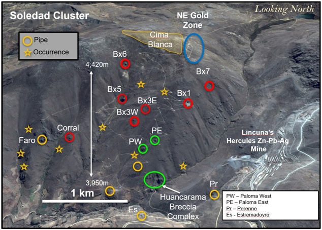
Source: Allegiant Gold Ltd.

Release – Golden Predator Mining Files Notice of Civil Claim Against Christman and Yukon Government


Golden Predator Mining Corp. Files Notice of Civil Claim Against Christman and Yukon Government


VANCOUVER, British Columbia, May 17, 2021 (GLOBE NEWSWIRE) — Golden Predator Mining Corp. (TSX.V: GPY; OTCQX: NTGSF(“Golden Predator“) announces that the Company has filed a Notice of Civil Claim in the Supreme Court of British Columbia on behalf of Janet Lee-Sheriff, CEO, and Golden Predator, Plaintiffs, against the Government of Yukon and Paul Christman (who was at all material times employed as the Chief Mine Engineer for the Government of Yukon) Defendants. The claim alleges that Mr. Christman, in the course of his employment with the Government of Yukon in 2020, falsely and maliciously spoke of and concerning Ms. Lee-Sheriff and Golden Predator. Mr. Christman has since left the position of Chief Mine Engineer for the Government of Yukon. The claim seeks relief against Mr. Christman and the Government of Yukon, including declarations concerning the defamations alleged, production of documents relating to Mr. Christman’s dealings and influence arising from his role in the Government of Yukon affecting Golden Predator, and general damages arising from the misconduct alleged. The allegations have not yet been proven in Court.

Golden Predator will continue to focus on advancing its Brewery Creek project in the Yukon through the permitting renewal process.       

ABOUT GOLDEN PREDATOR MINING CORP.
Golden Predator is advancing the past-producing Brewery Creek Mine towards a timely resumption of mining activities in Canada’s Yukon. The project has established resources grading over 1.0 g/t Gold and both a technical report and Bankable Feasibility Study underway to define the economics of a restart of heap leach operations at the Brewery Creek Mine. The 180 km2 brownfield property is located 55 km by road from Dawson City, Yukon and operates under a Socio-Economic Accord with the Tr’ondëk Hwëch’in First Nation. The Company also holds the Marg Project, with a 43-101 compliant resource, the Gold Dome Project and Grew Creek Project. For additional information on Golden Predator and the Brewery Creek Mine, please visit our website: www.goldenpredator.com.

FOR ADDITIONAL INFORMATION:

GOLDEN PREDATOR MINING CORP.
William Harris, Independent Director
(604) 260-0289
info@goldenpredator.com

Neither the TSX Venture Exchange nor its Regulation Services Provider (as that term is defined in the policies of the TSX Venture Exchange) accepts responsibility for the adequacy or accuracy of this release. No stock exchange, securities commission or other regulatory authority has approved or disapproved the information contained herein.

Golden Predator Mining Files Notice of Civil Claim Against Christman and Yukon Government


Golden Predator Mining Corp. Files Notice of Civil Claim Against Christman and Yukon Government


VANCOUVER, British Columbia, May 17, 2021 (GLOBE NEWSWIRE) — Golden Predator Mining Corp. (TSX.V: GPY; OTCQX: NTGSF(“Golden Predator“) announces that the Company has filed a Notice of Civil Claim in the Supreme Court of British Columbia on behalf of Janet Lee-Sheriff, CEO, and Golden Predator, Plaintiffs, against the Government of Yukon and Paul Christman (who was at all material times employed as the Chief Mine Engineer for the Government of Yukon) Defendants. The claim alleges that Mr. Christman, in the course of his employment with the Government of Yukon in 2020, falsely and maliciously spoke of and concerning Ms. Lee-Sheriff and Golden Predator. Mr. Christman has since left the position of Chief Mine Engineer for the Government of Yukon. The claim seeks relief against Mr. Christman and the Government of Yukon, including declarations concerning the defamations alleged, production of documents relating to Mr. Christman’s dealings and influence arising from his role in the Government of Yukon affecting Golden Predator, and general damages arising from the misconduct alleged. The allegations have not yet been proven in Court.

Golden Predator will continue to focus on advancing its Brewery Creek project in the Yukon through the permitting renewal process.       

ABOUT GOLDEN PREDATOR MINING CORP.
Golden Predator is advancing the past-producing Brewery Creek Mine towards a timely resumption of mining activities in Canada’s Yukon. The project has established resources grading over 1.0 g/t Gold and both a technical report and Bankable Feasibility Study underway to define the economics of a restart of heap leach operations at the Brewery Creek Mine. The 180 km2 brownfield property is located 55 km by road from Dawson City, Yukon and operates under a Socio-Economic Accord with the Tr’ondëk Hwëch’in First Nation. The Company also holds the Marg Project, with a 43-101 compliant resource, the Gold Dome Project and Grew Creek Project. For additional information on Golden Predator and the Brewery Creek Mine, please visit our website: www.goldenpredator.com.

FOR ADDITIONAL INFORMATION:

GOLDEN PREDATOR MINING CORP.
William Harris, Independent Director
(604) 260-0289
info@goldenpredator.com

Neither the TSX Venture Exchange nor its Regulation Services Provider (as that term is defined in the policies of the TSX Venture Exchange) accepts responsibility for the adequacy or accuracy of this release. No stock exchange, securities commission or other regulatory authority has approved or disapproved the information contained herein.

Golden Predator Mining (NTGSF)(GPY:CA) – Will Patience Be Rewarded?

Friday, May 14, 2021

Golden Predator Mining (NTGSF)(GPY:CA)
Will Patience Be Rewarded?

Golden Predator Mining Corp is a Canada based exploration stage company engaged in the business of acquiring and exploring mineral properties. It owns properties primarily in Yukon, Canada. Some of the company’s projects located in Yukon are the 3 Aces, Sprogge, Reef, Brewery Creek, Marg, Sonora Gulch, Grew Creek, Upper Hyland and others.

Mark Reichman, Senior Research Analyst of Natural Resources, Noble Capital Markets, Inc.

Refer to the full report for the price target, fundamental analysis, and rating.

    Bankable feasibility study (BFS). A bankable feasibility study, expected to be completed early in the third quarter of 2021, is being completed by Kappes Cassiday & Associates and will include a multi-year mine plan for Brewery Creek. In addition to an inventory of material on the heap to be re-processed and a plan to resume mining of material from leachable resources, it will also include a mine schedule, operating and capital cost estimates, and economic cash flow model. Completion of the BFS will enable the company’s Board of Directors to make a production and financing decision.

    License renewal applications.  During the first quarter, Golden Predator submitted renewal applications for its water use and quartz mining licenses associated with its Brewery Creek Mine. The licenses expire December 31, 2021 and the company seeks renewal for an additional 10 years under the existing terms. Future amendments to the licenses would be evaluated separately based on any proposals by …


This Company Sponsored Research is provided by Noble Capital Markets, Inc., a FINRA and S.E.C. registered broker-dealer (B/D).

*Analyst certification and important disclosures included in the full report. NOTE: investment decisions should not be based upon the content of this research summary.  Proper due diligence is required before making any investment decision. 

Comstock Mining (LODE) – Accelerating Progress on Multiple Fronts

Friday, May 14, 2021

Comstock Mining (LODE)
Accelerating Progress on Multiple Fronts

Comstock Mining Inc. is an emerging innovator and leader in the sustainable extraction, valorization, and production of scarce natural resources, with a focus on high value strategic materials that are essential to meeting the rapidly increasing global demand for clean energy, carbon-neutrality, and natural products.

Mark Reichman, Senior Research Analyst of Natural Resources, Noble Capital Markets, Inc.

Refer to the full report for the price target, fundamental analysis, and rating.

    Comstock provides first quarter update. Comstock hosted a virtual meeting with investors to discuss its first quarter financial results and to provide a corporate update. Management highlighted significant progress in all areas of its business. During the first quarter, Comstock Mining secured the rights to a majority equity position in LiNiCo Corporation, a private lithium-ion battery recycling company with a recycling facility in the Tahoe Reno Industrial (TRI) Center in Nevada. Management expects to exercise its $2.5 million warrant to increase its investment in LiNiCo during the third quarter, resulting in a majority stake and consolidation of LiNiCo’s financial results.

    Updated mineral resource estimate.  The company is expects to publish a S-K 1300 compliant technical report in the third quarter for the Dayton resource area. The technical report will provide a new resource estimate and include a phased drilling plan for further defining and expanding the resource. Subsequent technical reports will follow to expand the resource and provide economic analysis …


This Company Sponsored Research is provided by Noble Capital Markets, Inc., a FINRA and S.E.C. registered broker-dealer (B/D).

*Analyst certification and important disclosures included in the full report. NOTE: investment decisions should not be based upon the content of this research summary.  Proper due diligence is required before making any investment decision. 

Release – Endeavour Silver Announces 2021 Annual General Meeting Results


Endeavour Silver Announces 2021 Annual General Meeting Results

VANCOUVER, British Columbia,
May 12, 2021 (GLOBE NEWSWIRE) — Endeavour Silver Corp. (NYSE: EXK; TSX: EDR)
 announces that at the Company’s 2021 Annual General Meeting (“AGM”) held on May 12, 2021 in Vancouver, shareholders voted in favour of all items of business. A total of 67,521,897 votes were cast or represented by proxy at the AGM, representing 41.25% of the outstanding common shares as of the record date. The following is a tabulation of the votes submitted by proxy:

Director

Votes for

Votes withheld

Percent for

Percent withheld

Margaret M. Beck        

34,983,870

749,106

97.90%

2.10%

Ricardo M. Campoy

35,070,420

662,556

98.15%

1.85%

Bradford J. Cooke

33,801,339

1,931,637

94.59%

5.41%

Geoffrey A. Handley

33,025,727

2,707,250

92.42%

7.58%

Rex J. McLennan

34,891,330

841,646

97.64%

2.36%

Kenneth Pickering

35,004,529

728,448

97.96%

2.04%

Mario D. Szotlender

34,601,368

1,131,608

96.83%

3.17%

All director nominees were re-elected.

By a vote by show of hands, shareholders voted 98.09% in favour of re-appointing KPMG LLP as auditor of the Company and authorized the Board to fix the auditor’s remuneration for the ensuing year. In addition, shareholders also voted 97.51% in favour to reconfirm the Stock Option Plan, as amended by Amendment No. 5 and 97.75% in favour of the Share Unit Plan.

As previously announced, effective today, Bradford Cooke has been appointed Executive Chair of the Board and has stepped down as CEO. Dan Dickson has assumed the role of CEO and has been appointed to the Board, Christine West has assumed the role of CFO and Rex McLennan has been selected as Lead Director of Endeavour. Geoff Handley has stepped down as Chairman but plans to remain an active Director of the Company.

Bradford Cooke commented, “I want to thank all of the people who have supported me over the past 17 years in building up Endeavour Silver to the Company it is today, including our management team, board of directors and of course our shareholders. We have done some great things together but we are not half done yet.”

“The time has come to pass the management baton to our rising stars, Dan Dickson and Christine West. I plan to stay active with Endeavour, utilizing my knowledge of and contacts in the mining industry to continue building a bigger and better Company, and supporting Dan and Christine in their new roles. We appreciate the vote of confidence of our directors and shareholders.”

About Endeavour Silver – Endeavour Silver Corp. is a mid-tier precious metals mining company that owns and operates three high-grade, underground, silver-gold mines in Mexico. Endeavour is currently advancing the Terronera mine project towards a development decision and exploring its portfolio of exploration and development projects in Mexico and Chile to facilitate its goal to become a premier senior silver producer.  Our philosophy of corporate social integrity creates value for all stakeholders.

SOURCE Endeavour Silver Corp.

Contact Information:
Galina Meleger, Director Investor Relations
Toll free: (877) 685-9775
Tel: (604) 640-4804
Email: 
gmeleger@edrsilver.com  
Website: 
www.edrsilver.com